Portfolio
Atchafalaya Levees
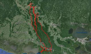
CSI performed several extensive profile surveys along the levees, floodwalls, structures, etc. depicting the line of protection for the entire Atchafalaya Basin System for the New Orleans Corps of Engineers in 2015.
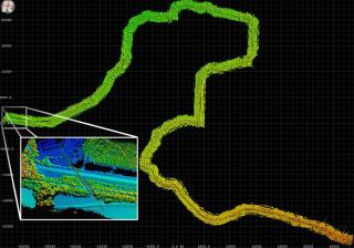
The project control consisted of an intricate system of Static GPS surveys utilizing over 80 monuments throughout the Atchafalaya Basin and surrounding areas and taking over four weeks to complete, spanning over 450 miles of levee. First, additional control was established throughout the area and constrained to NGS monuments with multiple Static GPS sessions, all tied to each other through repetition surveys. Once this primary control survey was complete. Baseline PI’s were strategically selected to reduce the distance between any two GPS monuments to less than 10 miles. Several Static GPS sessions were then conducted to tie in all of these secondary monuments also using redundancy within the networks to ensure quality GPS data.
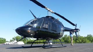
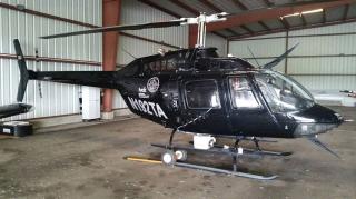
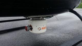
Several RTK survey crews were then deployed to each flood control structure to collect the profile and other required data for those areas. Chustz selected Tuck Mapping Solutions to assist in the aerial survey. Using their pilot and their Jet Ranger helicopter outfitted with a RIEGL VUX-1LR 3D laser scanner, we then conducted the levee profile surveys for over 450 miles of levee in just seven days, saving our clients time and money.
Project Gallery