Portfolio
Causeway Risers
CSI was asked by the New Orleans Corps of Engineers to perform a highly accurate survey of the causeway risers with both horizontal and vertical positions.
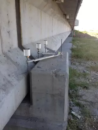
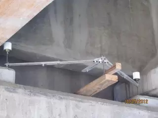
After discussing the inaccessibility of some of these points, it was decided and agreed upon by both parties that a Terrestrial LiDAR Survey would be the most accurate and economical means to collect the required data.
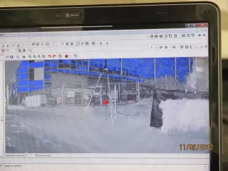
A five Person GPS Survey Party conducted the project control survey which consisted of a Static GPS Survey Network constrained to 3 NGS monuments. RTK control surveys, along with conventional total station and data collector surveys, combined with digital levels were used for additional control at the site. A two Person Terrestrial LiDAR Survey Party utilizing a RIEGL VZ-400 3D Laser Scanner was deployed to collect the required data for 834 riser points from 86 different scan positions.
This project required special equipment and remote access targeting devices that were designed and built by Chustz Surveying, LLC. Independent Technical Review (ITR) of the targeting devices resulted in height uncertainties of the targeting rods to be +/- 0.002 ft. Accessible riser points were surveyed twice as an additional Quality Assurance measure.
Project Gallery